
Connect building information with the systems teams already use
SIMLAB can act as a spatial layer that helps connect building context, asset information, documentation, and selected external systems.
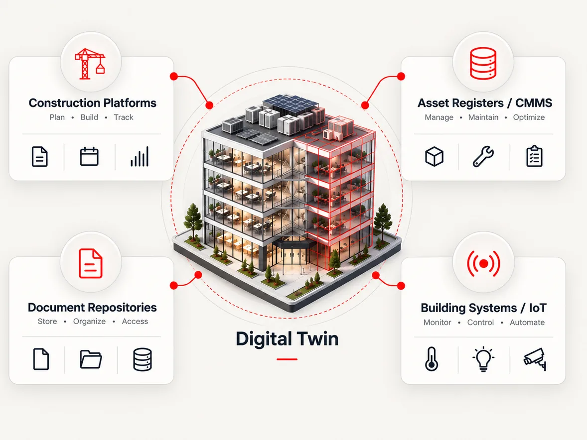
Systems describe buildings without enough spatial clarity.
Enterprise systems may hold valuable data, but teams often need spatial context to understand where information belongs and how it relates to the physical environment.
Systems are disconnected from site reality
Records live in platforms that were never designed to show where things are, so data and the physical building drift apart.
Asset data lacks visual context
An asset register tells you what exists, but not where it stands, what surrounds it, or what it actually looks like on site.
Construction and operations tools may not align
Information created during delivery rarely lands cleanly in the systems operations teams use, so context is lost at handover.
Teams move between too many systems
Answering one question about one room can mean opening four platforms, and none of them agree on where the answer belongs.
A spatial layer between systems and building context.
Instead of replacing the platforms your organization runs on, SIMLAB sits between them and the physical building - giving their data a place, not just a table.
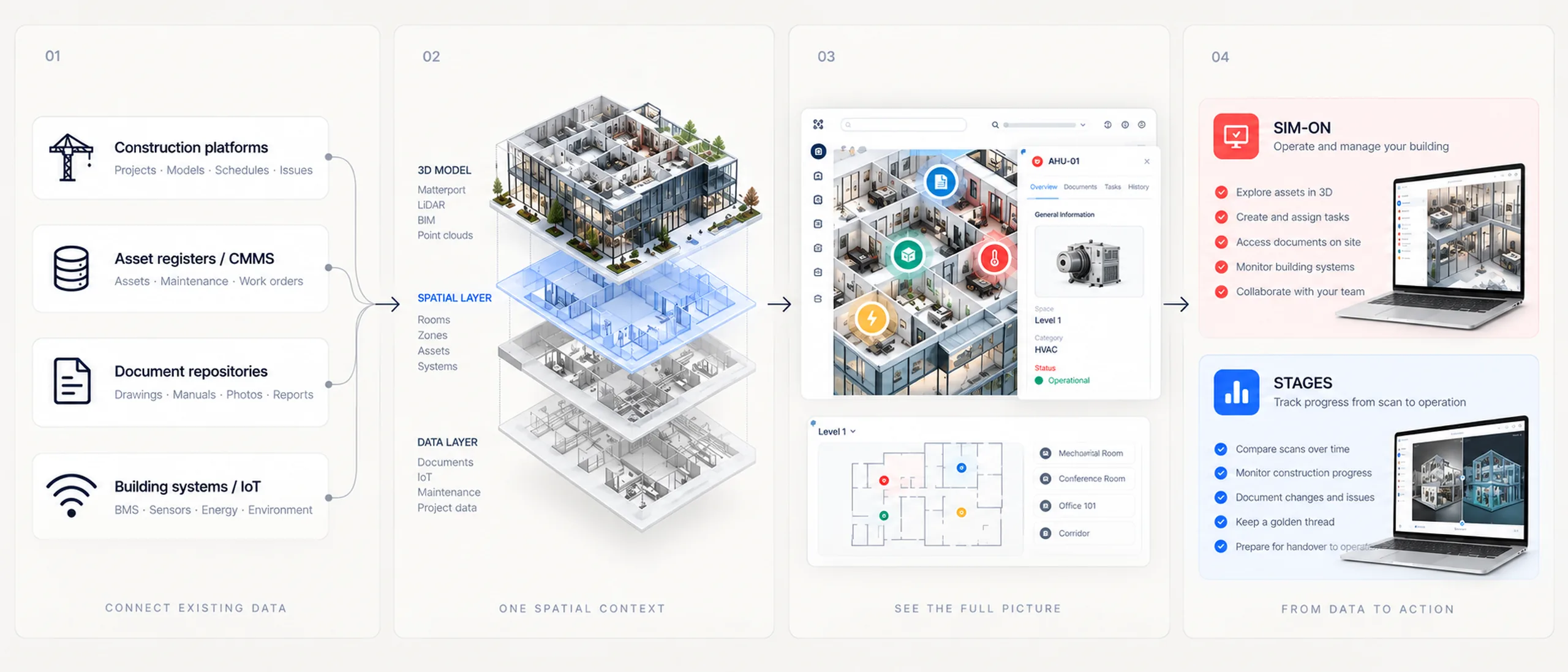
Source system
Construction platforms, asset registers, document repositories, and building systems keep holding the records your teams rely on today.
SIMLAB spatial context
Selected data is connected to precise locations inside an accurate digital twin of the building or facility.
Digital twin interface
Records, documents, and readings appear anchored to the rooms, assets, and equipment they describe.
User workflow
Teams act on information in context: SIM-ON for assets and daily operations, STAGES for construction documentation and handover.
Example integration workflows.
Typical patterns organizations explore with SIMLAB - always scoped with IT and system owners, and always with your existing platforms staying in charge of their data.
Construction platform data connected to spatial tags
Where approved, records from construction management platforms such as Procore can be linked to spatial tags in STAGES, so issues and documentation stay attached to the exact location they describe.
Asset system data connected to digital twin objects
SIMLAB can support connections to asset and maintenance systems such as IBM Maximo where approved, so asset records appear on the tagged equipment inside the twin.
IoT or building data shown in location context
Readings from connected building and automation systems can be displayed at the asset location in SIM-ON, where applicable, instead of in a separate dashboard.
Documents connected to physical rooms or assets
Manuals, drawings, certificates, and O&M files can be attached to the rooms and assets they describe, one click away from the space itself.
Approved ecosystem examples.
SIMLAB can support connections to platforms such as Procore, IBM Maximo, Matterport, NavVis, Leica, and Faro where approved. We name partners and show logos only where the relationship is confirmed.
Implementation and data, answered.
The questions IT leaders and system owners ask first when they evaluate SIMLAB as a spatial layer.
Do we have to replace our existing systems?
No. SIMLAB works as a spatial layer alongside the tools your teams already use. Your existing platforms remain the system of record, and SIMLAB adds the building context around them.
Which platforms can SIMLAB connect to?
SIMLAB can support connections to platforms such as Procore, IBM Maximo, Matterport, NavVis, Leica, and Faro where approved. Each integration is scoped case by case with your IT team and system owners.
How does data flow between systems?
That depends on the scoped integration. In typical patterns, selected records are referenced or synchronized so they can be viewed in spatial context, while the source system keeps ownership of the data.
What does implementation usually look like?
Most organizations start with a pilot: one building or area, one or two data sources, and a clearly defined user workflow. The integration scope grows from there based on what proves useful.
How is access managed?
Access is managed per organization, project, and role, so different teams see the spaces and data relevant to them. Security and data-handling requirements are reviewed with your IT team during scoping.
Who maintains an integration over time?
Ownership is agreed during scoping. SIMLAB and approved partners can support setup, monitoring, and changes as your systems and buildings evolve.
Discuss your integration architecture.
Tell us which systems your teams rely on and what spatial context would change for them - we will walk through how SIMLAB can support the connection.