
Digital twin visibility for warehouse and logistics facilities.
Make large, changing spaces easier to document, review, plan, and operate through spatially organized facility information.
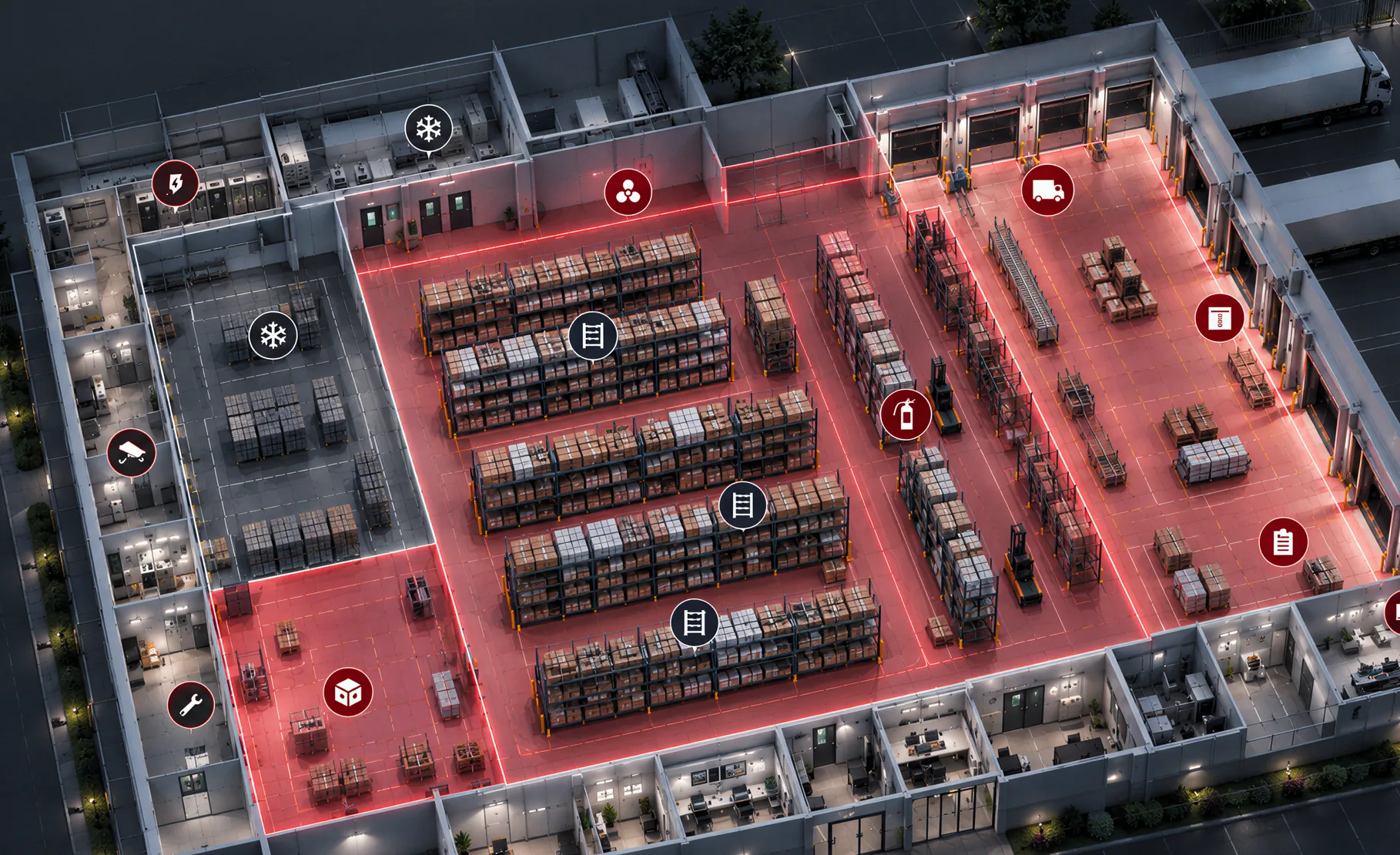
Large spaces change faster than documentation can keep up.
Warehouse environments evolve constantly through layout changes, equipment updates, operational zoning, contractor work, and maintenance needs. The paperwork rarely keeps pace.
Layouts change over time
Racking moves, zones get redrawn, and mezzanines are added, while floor plans stay frozen at the last big project.
Racking, zones, equipment, and documents are not always connected
Asset lists, manuals, and inspection notes live in separate systems with no link to where things actually sit on the floor.
Remote stakeholders need accurate site context
Owners, planners, and vendors make decisions from phone calls and photo threads instead of seeing the space as it is today.
Planning teams rely on outdated photos or drawings
Retrofit and maintenance work often starts with a site visit just to confirm basic conditions that should already be on record.
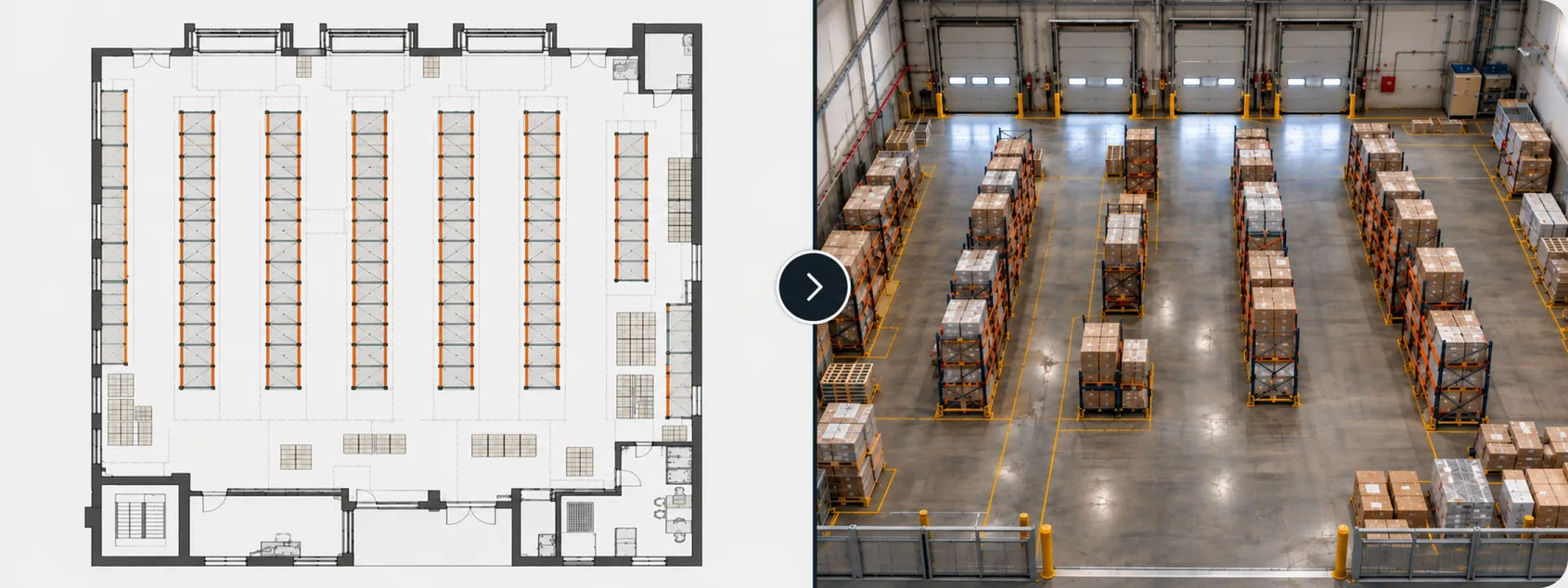
The questions that should take seconds.
Warehouse teams already hold layouts, asset lists, manuals, inspection notes, and vendor documentation. It usually sits in separate systems, and very little of it says where on the floor something is. The problem is no longer lack of data.
- 01
What does the floor look like today?
A current, navigable record of the floor plan, racking, and zones replaces drawings that age out between projects.
- 02
Which zone does this rack belong to, and what is attached to it?
Racking configurations and zone assignments are documented in spatial context, with related records attached where they apply.
- 03
Can someone walk the facility without being there?
Walk the facility from a browser to review conditions, answer questions, and cut down on unnecessary site visits.
- 04
Will a vendor quote against the real space?
Vendors and contractors are briefed against the real space, so scopes, quotes, and access plans start from accurate context.
- 05
Where does this equipment sit, and what has been done to it?
Equipment records and service history are attached to the exact location of each asset on the floor.
- 06
How does this site compare with the others?
Multiple facilities in one consistent spatial format make it possible to compare layouts, capacity, and conditions across the network.
- 07
Are we planning the retrofit from reality or from assumptions?
Planning and fit-out teams get current site conditions, so retrofit concepts start from reality rather than from the last set of drawings.
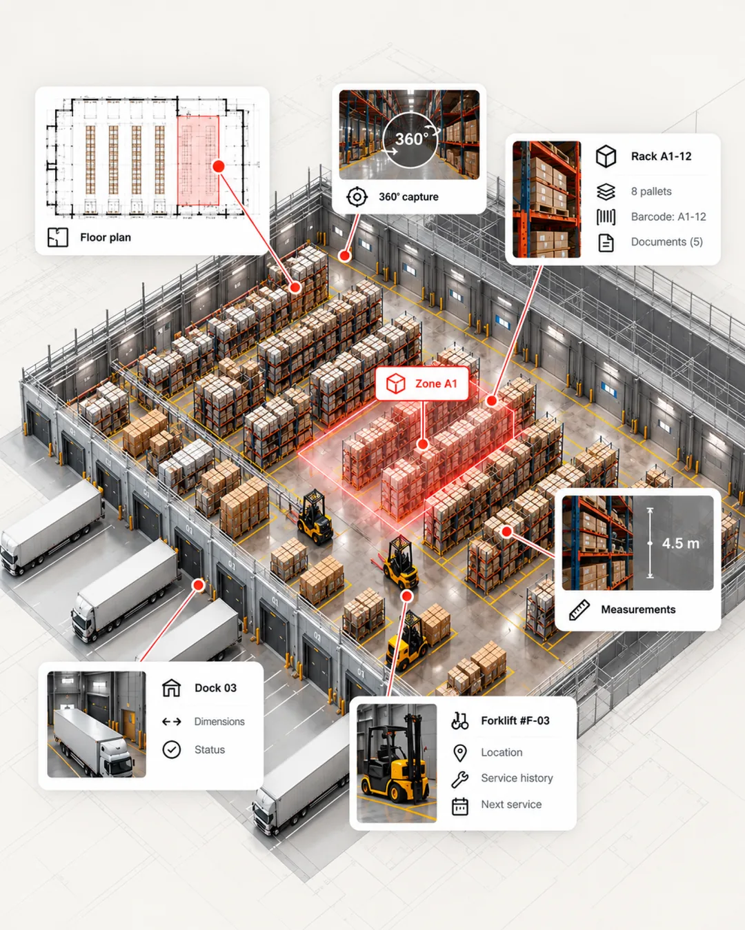
One zone, from the floor to the record.
A single zone shows what changes when the record is connected. The interface shown here is illustrative rather than a live customer system, and it follows the steps a planner or a vendor actually takes.
Find it in space
The aisle, the zone, and the dock are something you look at, not something you reconstruct from a location code and a drawing that has not been reissued.
Spatial Digital TwinSee how it is organized
The twin is structured around zones, storage areas, and equipment, so information sits where the work happens.
Read what is attached
Layouts, manuals, inspection records, and vendor documentation open from the location and the asset they belong to.
Walk it remotely
Internal teams, vendors, and stakeholders share one walkthrough of the facility from anywhere.
Plan the next change
Retrofit and maintenance work starts from the record, rather than from a site visit made only to confirm basic conditions.
Asset & Facility Management
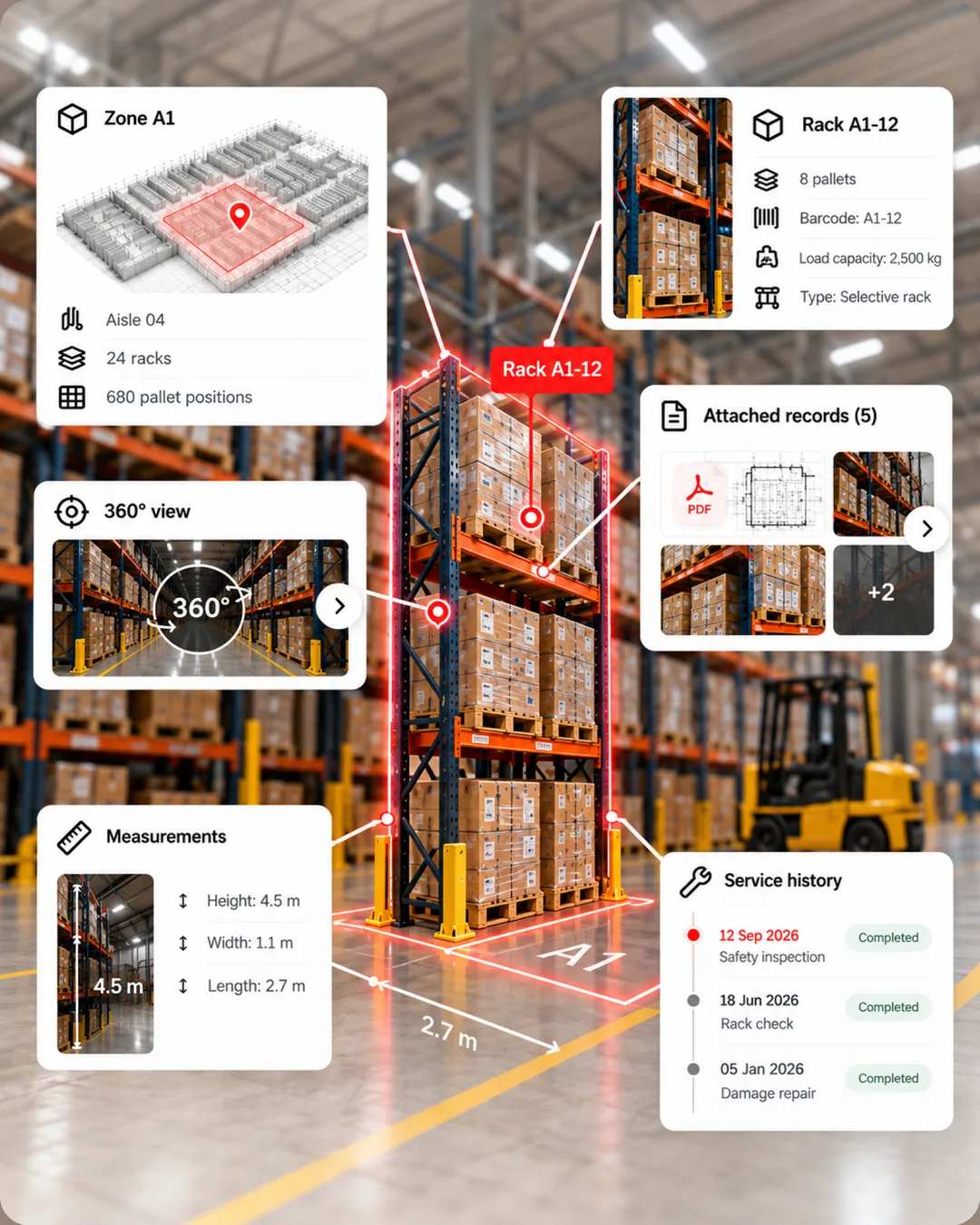
The interface shown here is illustrative rather than a live customer system.
You do not need to start over.
SIMLAB connects multiple visual and spatial inputs into one environment, so teams can read a facility at the level of detail a task needs. These are supported visual context examples, not a fixed list.
Immersive 360 capture
Walkthroughs of aisles, docks, and support areas, useful when someone needs to see the floor without booking a visit.
Industrial-grade scanning
Accurate capture of large facilities, for spaces that are too big for a folder of photos to cover.
BIM
Design and engineering context for the building and its services, carried into the operational record.
Point cloud
Precise spatial documentation for the moments when a clearance or a rack position has to be verified rather than estimated.
2D floor plans
Zones, layouts, and referencing, in the format planners and operators already read.
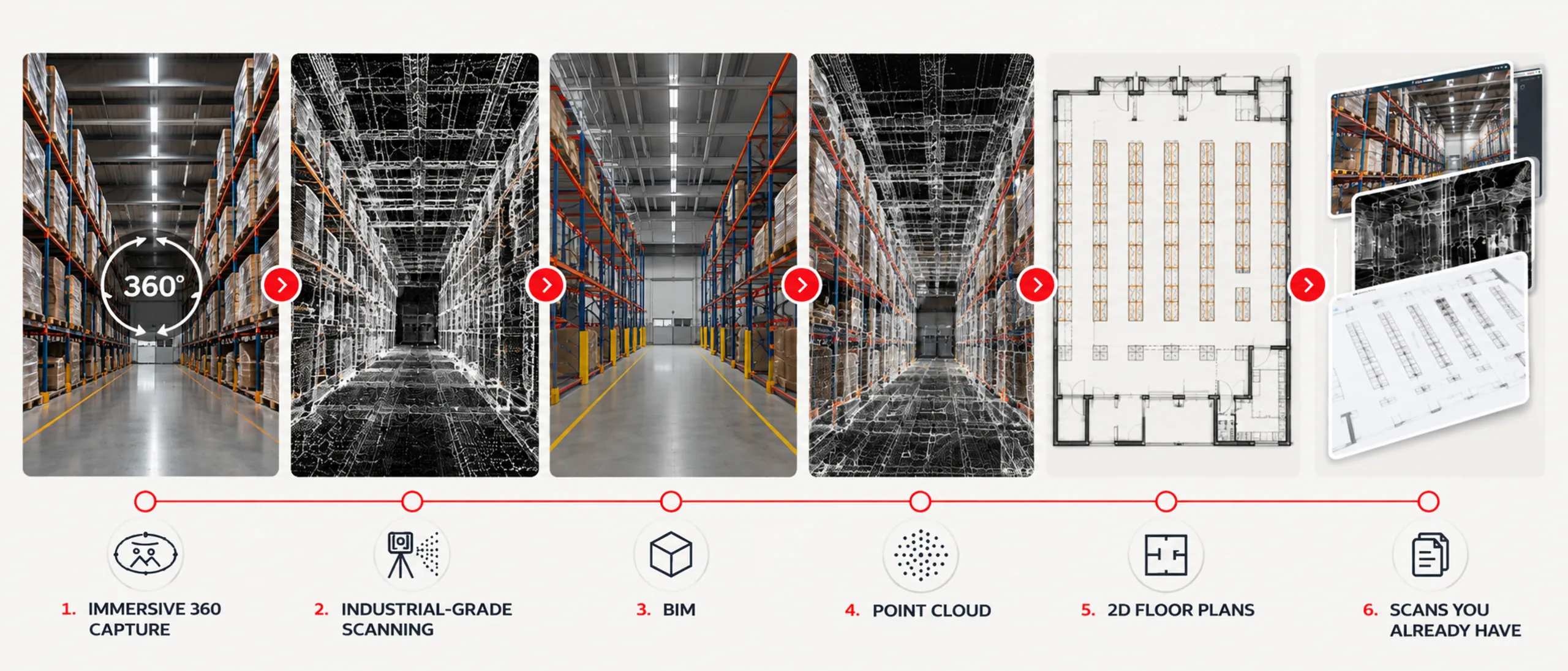
A retrofit can be reviewed against a 2D layout, checked against point cloud data, compared with BIM design intent, and explored remotely through immersive capture.
Your systems keep their data. The spatial layer shows where it belongs.
Warehouse teams already use specialized systems to manage assets, maintenance, and building operations. SIMLAB does not replace them. It gives their records a place on the floor, so asset lists, service history, and building data can be understood in the space they describe.
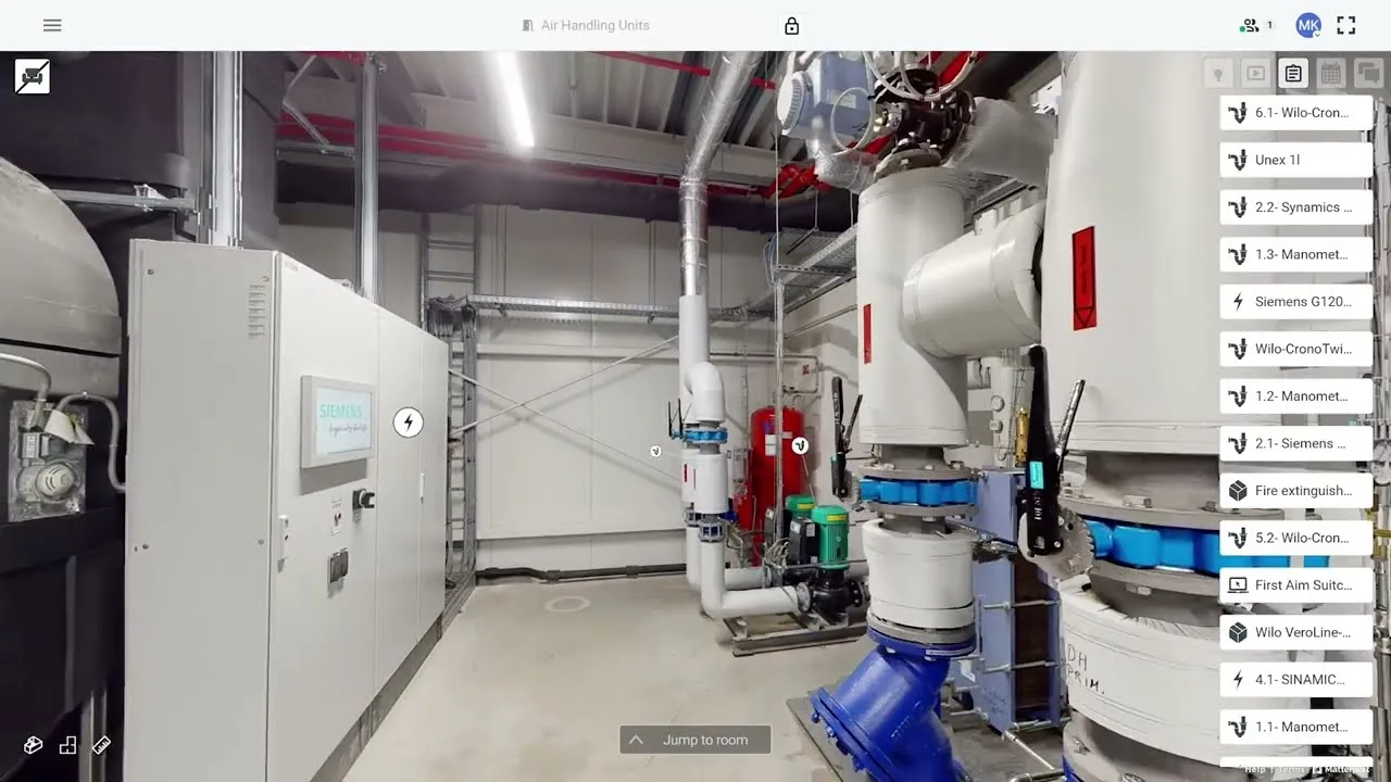
SIM-ON asset management (0:33, opens on YouTube): an asset list in a scanned plant room, then a pump's record opened at its position, with photos, drawings, videos and documents.
Two products, one continuous record of the facility.
Racking moves and mezzanines are added long after the last set of drawings was issued. Where the facility is already operating, SIM-ON is the starting point. STAGES joins when a retrofit, an expansion, or a fit-out begins.
The line between them
Comparing design intent against what was built belongs to the project record. Tracking what has moved on the floor since belongs to operations.
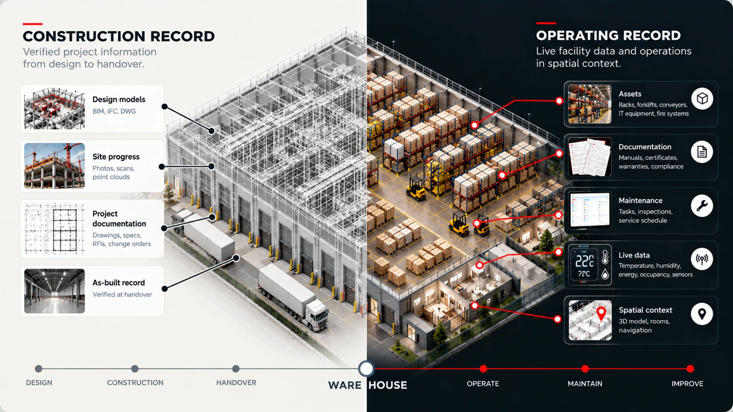
From a scanned space to a current spatial record.
Five steps, scoped to your facility and your existing systems, from capturing the space to keeping the record current through every reconfiguration.
- 01
Capture space
Scan the facility to create an accurate, navigable model of aisles, racking, docks, and support areas as they stand.
Reality Capture Services - 02
Organize zones and assets
Structure the twin around zones, storage areas, and equipment so information sits where the work happens.
- 03
Connect documents
Attach layouts, manuals, inspection records, and vendor documentation directly to locations and assets.
- 04
Enable remote review
Give internal teams, vendors, and stakeholders a shared walkthrough of the facility from anywhere.
- 05
Maintain operational record
Re-capture as the facility changes so the spatial record stays current through every reconfiguration.
Warehouse & Logistics is one of seven environments SIMLAB supports.
Every one of them runs a building whose assets, documents, sensor data, and change history outgrew the drawings that describe it, and where the people responsible for the assets and the people responsible for the documentation sit in different places. The workflow is the same. The vocabulary changes.
Warehouse & Logistics
Large spaces that change faster than the drawings, across shifts and sites that rarely see each other's floor.
You are hereBuild a connected spatial record of your warehouse and logistics facilities.
SIMLAB connects layouts, zones, assets, documentation, and change history inside one spatial environment, so large spaces can be documented, reviewed, and managed in context.
Speak With Our Team
Bring a floor plan, a scan, or nothing at all. The first conversation is about which question costs your team the most time, and that is enough to scope what comes after.
Explore Our Products
SIM-ON carries the site into daily operations. STAGES carries construction documentation and handover. Both read from the same facility record.