
Spatial digital twins that turn buildings into operational environments.
Create a spatially organized digital layer where buildings, assets, documents, and workflows can be accessed and understood in context.
What is a spatial digital twin?
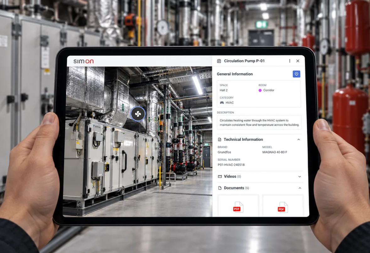
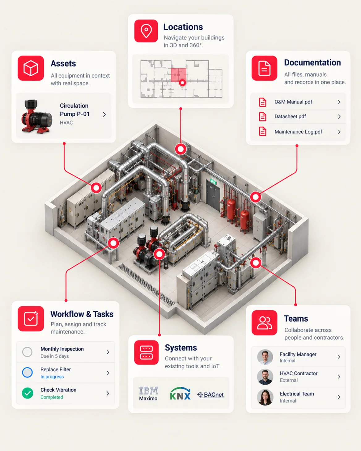
A spatial digital twin is a navigable digital representation of a real environment that can connect physical locations with assets, documentation, workflows, systems, and teams.
The result is not another viewer. It is a shared spatial reference where every piece of information about the building has a place, and every place can carry information.
Spatial digital twin teaser - devices pinned to 3D building scans
Length3D building scans, protocol logos, then device cards and icons pinned to rooms of scanned and rendered floor plans.
Read what the video showsHide description
On a dark background, rotating 3D scans of interiors appear: a room with rows of beds, an MRI suite, office floors and a car showroom and workshop. A title card reads "TRANSFORM EVERY PROPERTY INTO DIGITAL TWIN EXPERIENCE". Protocol and vendor logos follow, including zigbee, KNX, BACnet, Nice, SmartThings, Schneider Electric, NETx Automation, DALI, M-Bus, SNMP, OPC, MQTT and Modbus. Captions read "MANY VENDORS", "MANY PROTOCOLS" and "CONNECTED TO A SINGLE PLATFORM". A red power-button icon appears inside a dotted ring, and grey device cards such as "AC - Living room", "Amper total" and "Front door" circle it. The cards gather around a 3D scan of an interior with a checkered floor, each with a name and state, for example "Entry" with "MOTION DETECTED", "Living room" with "20°C" and "Smoke sensor" with "NO WARNING". The cards shrink into green and grey icons placed in the rooms. Similar icons appear on a rendered apartment, a rendered house with a garage, a wider view of the scanned interior and two scanned homes.
Why static documentation is not enough.
Most building information lives in folders, drives, and systems that have no connection to the physical spaces they describe. That gap costs time every single day.
Files are separated from physical context
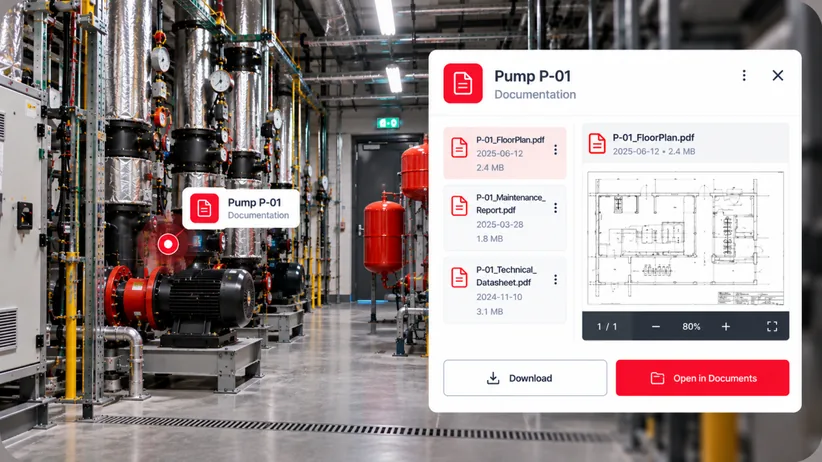
Drawings, manuals, and reports live in folders and drives that say nothing about where in the building they actually apply.
Teams lose time searching for information
People spend hours digging through file shares and email threads for the one record that answers a location-specific question.
Site knowledge is hard to transfer
When experienced staff rotate or leave, their understanding of where things are and why they matter often leaves with them.
Remote stakeholders lack confidence in what they see
Photos and written reports rarely give distant decision makers enough context to trust their picture of the site.
Connect space, data, and workflow.
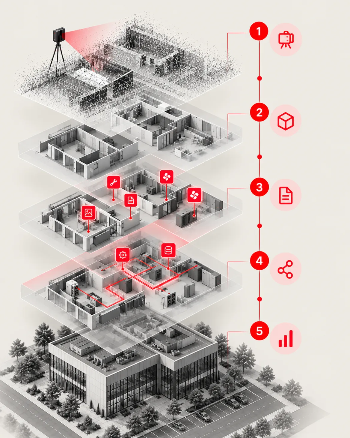
SIMLAB builds a spatial layer over your real environment, then anchors the information and workflows your teams already rely on to the places where they belong.
- 01
Capture environment
Reality capture creates an accurate, navigable model of the real environment, from a single floor to an entire portfolio of buildings.
- 02
Build spatial layer
The captured environment becomes a structured spatial layer where every room, corridor, and zone has a precise, shareable address.
- 03
Attach assets and records
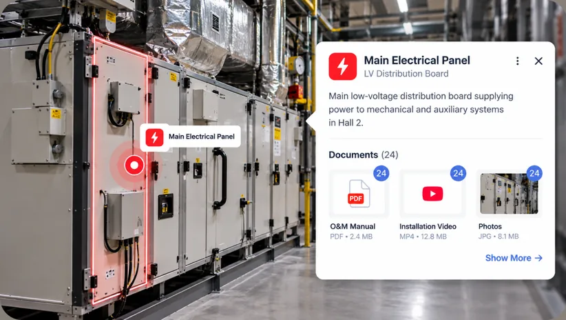
Equipment, documentation, photos, and notes are anchored to the exact physical locations they describe.
- 04
Connect tasks and systems
Issues, tasks, and operational systems can link to the same spatial reference where approved, so work happens in context.
- 05
Use across lifecycle
The same twin supports construction documentation, handover, and daily operations as the building changes over time.
Where spatial digital twins create value.
The same spatial foundation supports very different environments. Wherever buildings, assets, and teams need to stay aligned, a spatial digital twin gives them one shared reference.
How this connects to SIM-ON and STAGES.
One platform, two products. STAGES documents the building while it is being built. SIM-ON puts the finished environment to work. Together they carry a consistent spatial record from construction through operations.
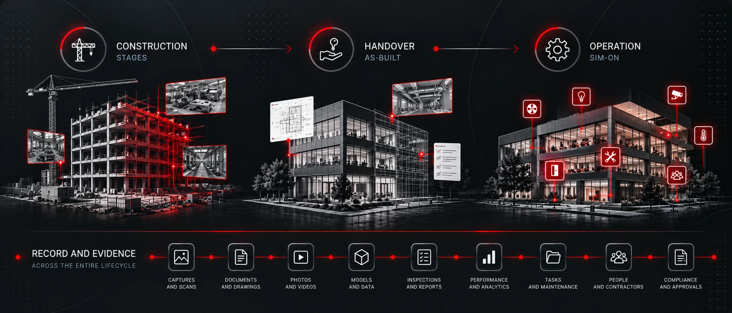
Evidence and record workflows sit at the SIMLAB platform level, where STAGES and SIM-ON work together across the building lifecycle.
Common questions.
Quick answers for teams evaluating what a spatial digital twin means in practice.
Is a spatial digital twin the same as a 3D scan?
No. A scan or capture is the starting point. A spatial digital twin adds structure on top: assets, documentation, tasks, and system connections anchored to locations, so the model becomes a working environment rather than a picture.
Do we need BIM to get started?
No. Reality capture alone is enough to build the spatial layer. Where BIM models exist, STAGES supports split-screen comparison between the model and the captured reality.
Which capture technologies can SIMLAB work with?
SIMLAB can support common reality capture hardware and platforms, including Matterport, NavVis, Leica, and Faro, where approved. Our Reality Capture Services can also connect you with experienced capture partners.
Can the twin connect to systems we already use?
The SIMLAB platform can connect with asset, facility, and project systems where approved, so the spatial layer complements existing workflows instead of replacing them.
Who uses the digital twin day to day?
Facility and estates teams, project and construction teams, and remote stakeholders who need reliable context without traveling to the site for every question.
Explore spatial digital twin workflows for your building.
Talk to an expert about how a spatial layer could organize your assets, documentation, and daily operations around the building itself.