
Spatial intelligence for public sector estates.
Support public buildings and facility teams with clearer access to spatially organized asset, documentation, and building information.
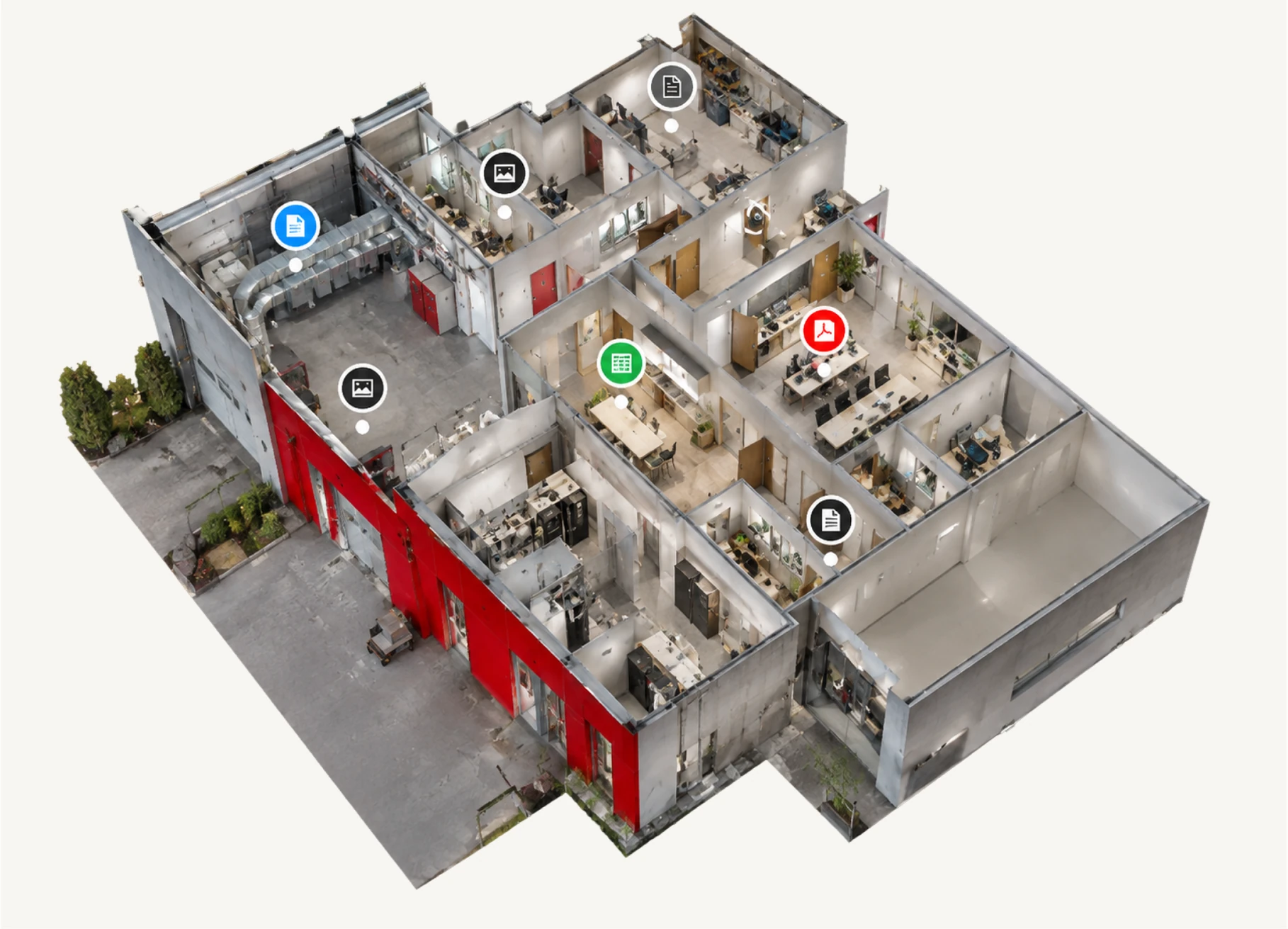
Public estates need accessible, accountable building information.
Large public estates can involve many buildings, stakeholders, maintenance teams, records, and workflows. Spatial context helps make building information easier to locate and use.
Records fragmented across departments
Building documentation often lives in separate systems, archives, and formats, which slows down the everyday decisions that depend on it.
Consistency at estate scale
Large estates require consistent documentation practices across many buildings, teams, and service providers, not one-off filing habits.
Reliable information for reviews
Maintenance, capital planning, and periodic reviews all depend on building information that teams can trust and reference quickly.
Too many avoidable site visits
Remote access to a clear visual record can reduce trips made just to check a room, an asset, or a current condition.
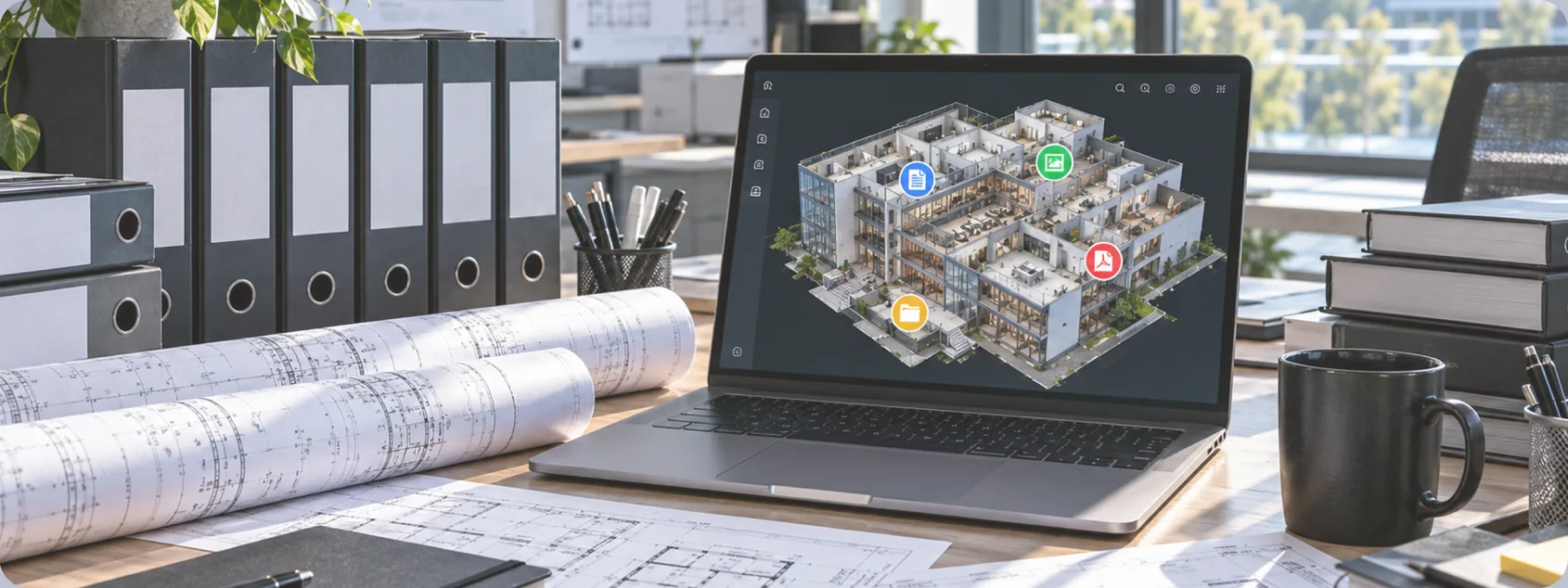
The questions that should take seconds.
Public estate teams already hold floor plans, models, photos, asset data, and historical records for every building. It usually sits in separate systems, and very little of it says where in the building something is. The problem is no longer lack of data.
- 01
Where is the current record for this building?
Floor plans, photos, and building records for every facility sit in one spatially organized place, from administrative buildings to depots.
- 02
Where does this equipment sit inside the building?
Equipment and building systems are visible where they actually are, with asset details attached to their locations.
- 03
Can maintenance prepare before arriving?
Maintenance teams review conditions, locate assets, and prepare work with visual context before they arrive on site.
- 04
Can a review happen without traveling across the estate?
Facilities can be walked remotely for planning and reviews, reducing unnecessary travel across a distributed estate.
- 05
Do contractors and providers point to the same location?
Contractors and service providers share a clear spatial reference, so scopes, notes, and issues point to exact locations.
- 06
Will the records still be usable after handover?
Documentation from construction and renovation projects carries into operations, so records stay usable long after handover.
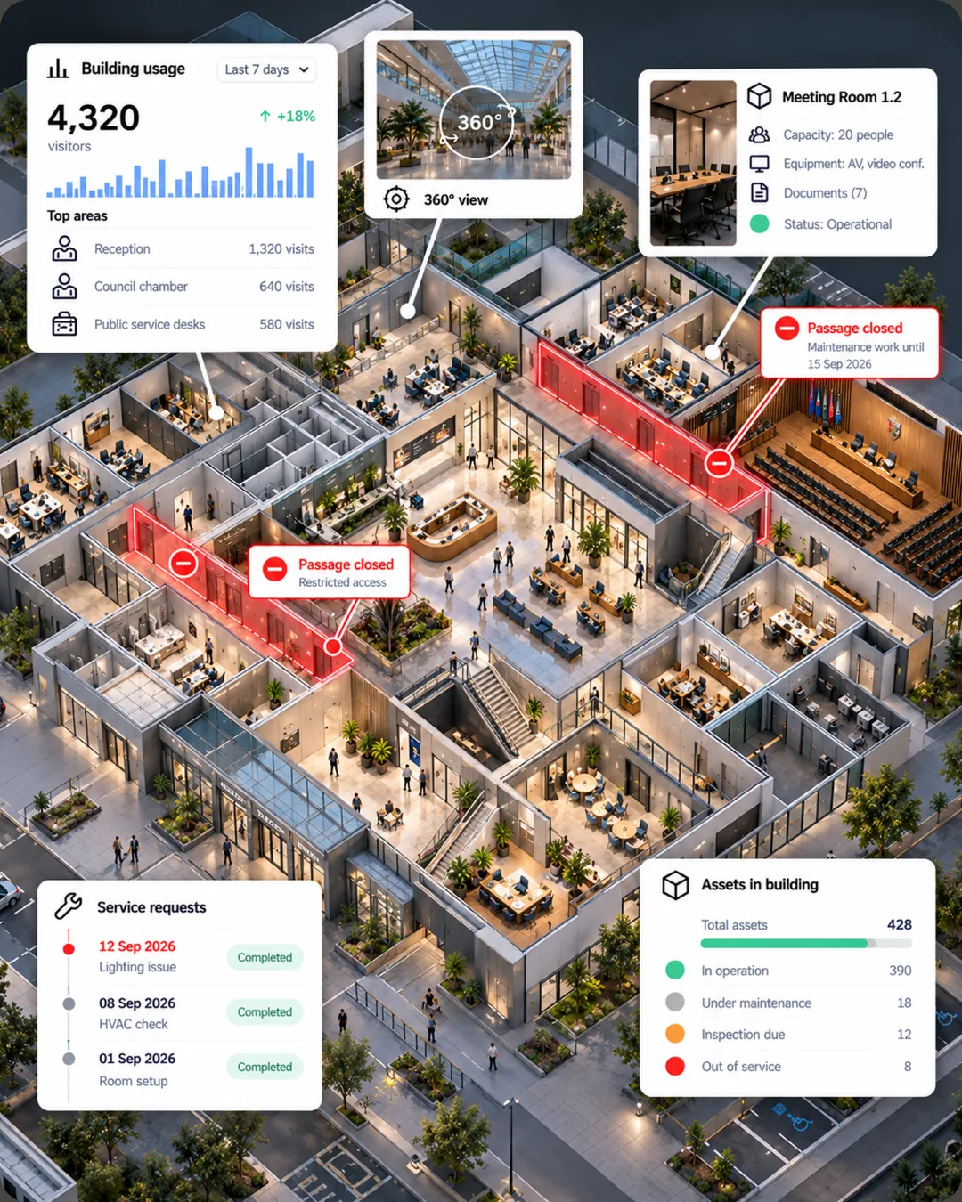
One building, from the estate to the record.
A single building shows what changes when the record is connected. The interface shown here is illustrative rather than a live customer system, and it follows the steps an estate or facilities team actually takes.
Find it in the estate
The building, the floor, and the room are something you look at, not something you reconstruct from an archive reference and a set of plans.
Spatial Digital TwinOpen the record
Plans, models, photos, and documents sit around an accurate spatial model of the facility rather than in separate archives and formats.
Read what is attached
Asset data, manuals, and historical records open from the location they describe.
Review it in place
Maintenance, capital planning, and periodic reviews work from information teams can trust and reference quickly.
Carry it past handover
Documentation from construction and renovation projects continues into operations, so records stay usable long after handover.
Construction Documentation & Handover
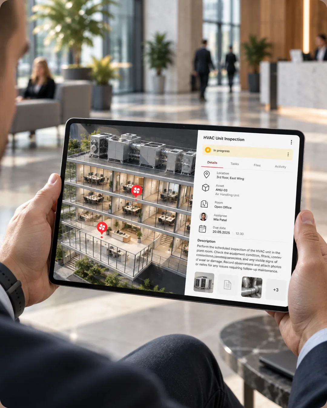
The interface shown here is illustrative rather than a live customer system.
You do not need to start over.
SIMLAB connects multiple visual and spatial inputs into one environment, so teams can read a building at the level of detail a task needs. These are supported visual context examples, not a fixed list.
360 photo capture
Immersive walkthroughs for remote review, useful when a stakeholder needs to see a building without a trip across the estate.
Industrial-grade scanning
Accurate capture of facilities across regions with consistent quality, supported by SIMLAB's reality capture network.
BIM
Design and engineering context, carried into the operational record instead of staying behind in the project archive.
Point cloud
Precise spatial documentation for the moments when a measurement has to be defensible rather than approximate.
2D floor plans
Plans, zones, and referencing, in the format estate and facilities teams already use.
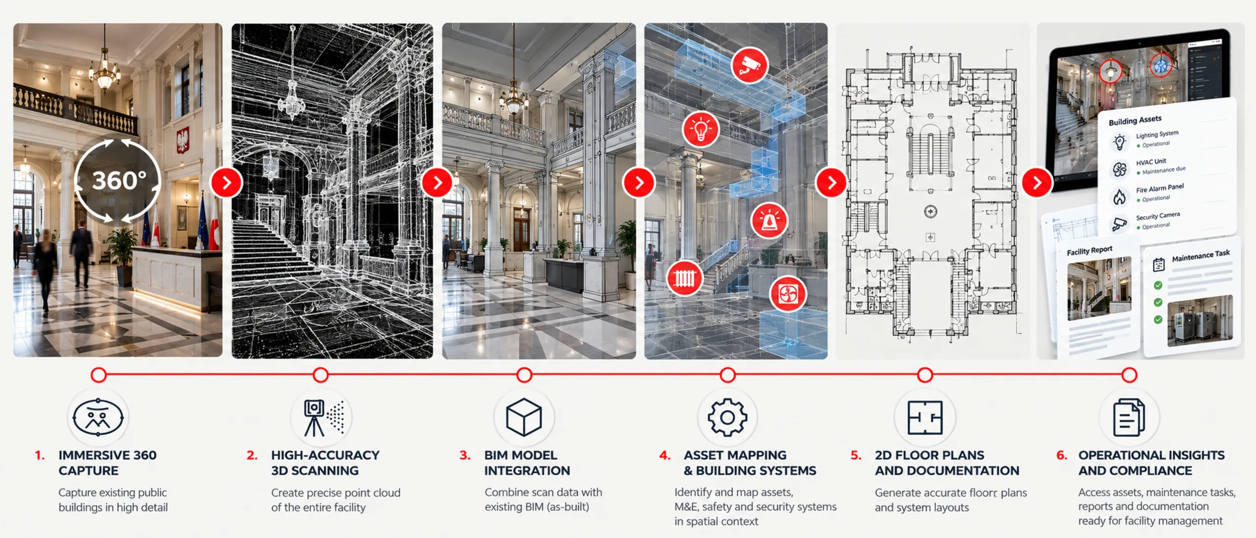
A building can be reviewed against a 2D plan, checked against point cloud data, compared with BIM design intent, and explored remotely through immersive capture.
Your systems keep their data. The spatial layer shows where it belongs.
Public estates already run on specialized systems for assets, maintenance, and building services, often held by different departments. SIMLAB does not replace them. It gives their records a shared spatial reference, so building information is easier to locate and use.
One building record, from project to operations.
SIMLAB pairs construction documentation with day-to-day operational tools, so the information created during a project keeps working for the teams who run the building. Used together, STAGES and SIM-ON can support record-keeping and evidence workflows at the platform level, helping estate teams maintain audit-ready records of how buildings were delivered and how they are maintained.
The line between them
Comparing as-designed against as-built belongs to the project record. Tracking what changed in a building after handover belongs to operations.
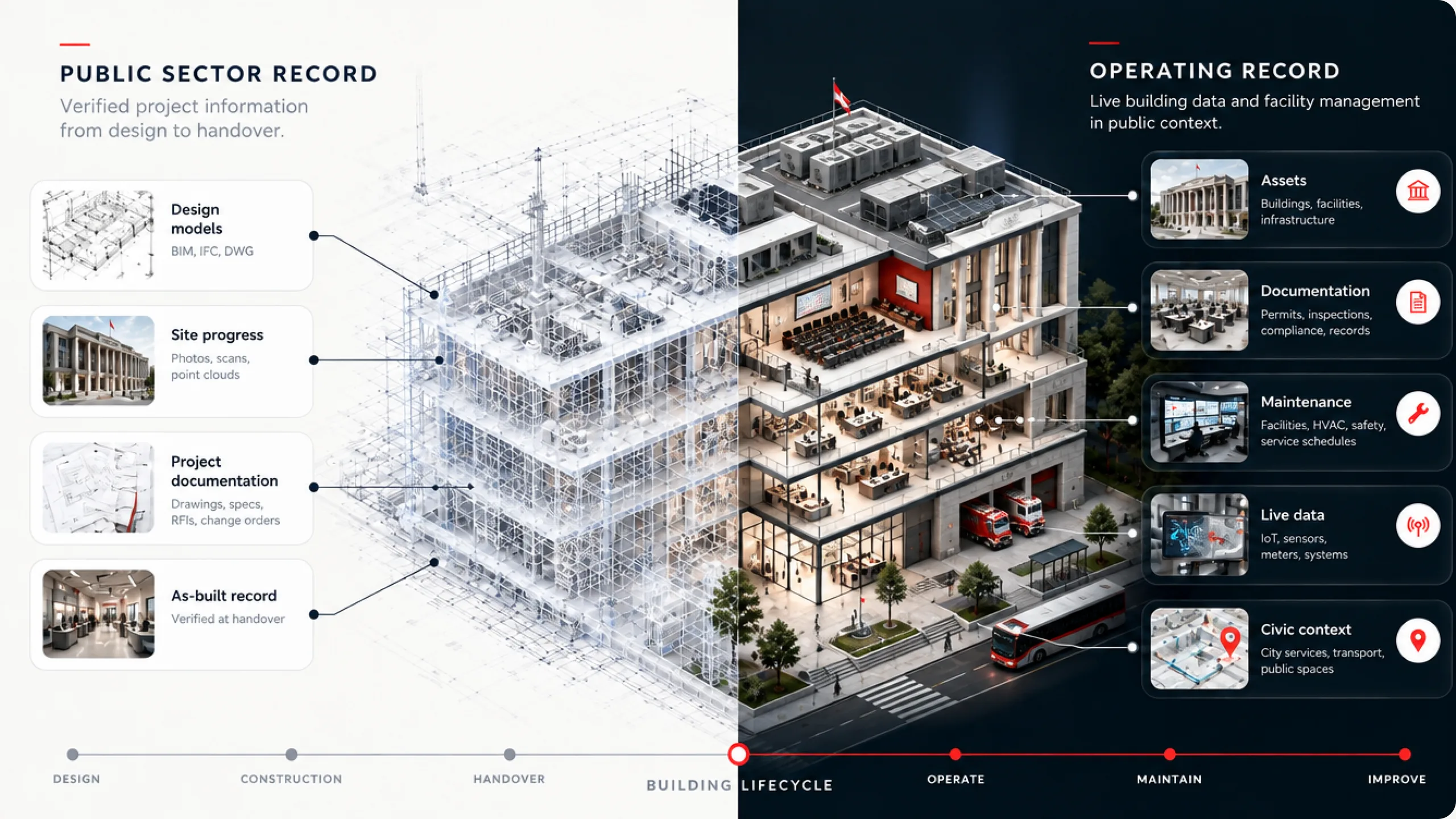
From captured buildings to a consistent estate record.
Five steps, scoped to your estate and your existing systems, applying the same structure to every building so information stays consistent as the portfolio grows.
- 01
Capture public facilities
Document buildings across the estate with 360 photo capture and scanning, supported by SIMLAB's reality capture network.
Reality Capture Services - 02
Structure building records
Organize plans, models, photos, and documents around an accurate spatial model of each facility.
- 03
Connect documentation
Link asset data, manuals, and historical records to the exact locations they describe.
- 04
Support operational workflows
Give maintenance, planning, and review teams a shared spatial reference for daily work.
- 05
Scale across the estate
Apply the same structure to every building, so information stays consistent as the portfolio grows.
Public Sector is one of seven environments SIMLAB supports.
Every one of them runs a building whose assets, documents, sensor data, and change history outgrew the drawings that describe it, and where the people responsible for the assets and the people responsible for the documentation sit in different places. The workflow is the same. The vocabulary changes.
Public Sector
Publicly accountable assets, where a defensible record of what exists and what changed matters as much as the asset itself.
You are hereBuild a connected spatial record of your public estate.
SIMLAB connects buildings, assets, documentation, and project history inside one spatial environment, so public estates have building information that is easier to locate and use.
Speak With Our Team
Bring a floor plan, a scan, or nothing at all. The first conversation is about which question costs your estate team the most time, and that is enough to scope what comes after.
Explore Our Products
SIM-ON carries the site into daily operations. STAGES carries construction documentation and handover. Both read from the same facility record.