
A spatial layer for building data and digital transformation.
Connect physical environments, operational systems, and digital workflows through spatial context.
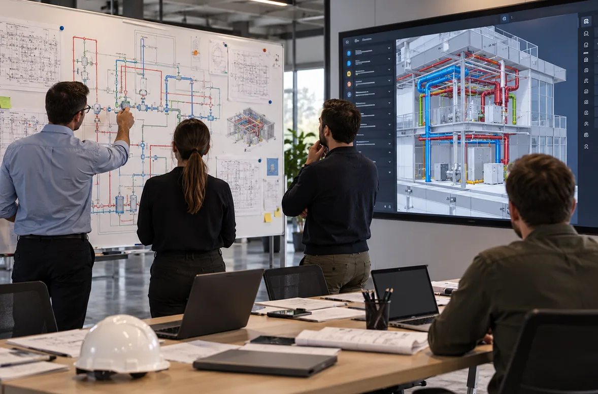
Digital transformation needs building context.
Most enterprise stacks describe what is happening. Few of them can show where. That gap is what keeps building data hard to use.
Systems are disconnected from the physical environment
CMMS, BMS, document stores, and IoT platforms each hold part of the picture, but none of them knows where anything actually sits in the building.
Data is difficult to interpret without location
A sensor reading, a work order, or an asset record means little on its own. It becomes actionable when you can see the space it refers to.
Teams use multiple interfaces
Every extra tool adds logins, training, and another version of the truth. Adoption suffers when spatial context lives nowhere.
Scaling across sites requires repeatable structure
Pilots succeed in one building, then stall. Without a repeatable data structure, every new site becomes a new project.
How SIMLAB fits into the technology landscape.
SIMLAB is not another system of record competing with your stack. It is the spatial layer between the physical environment and the tools your teams already use.
Physical environment
The buildings, spaces, and equipment your organization actually operates.
Spatial digital twin
A navigable model of each site, built from reality capture and aligned with BIM where available.
Assets and documents
Equipment records, documentation, and history anchored to their real locations in the model.
Systems and integrations
Enterprise platforms connected where approved, so existing data gains spatial context instead of moving to yet another silo.
User workflows
Everyday tasks for operations, maintenance, and project teams, carried out in one spatial interface.
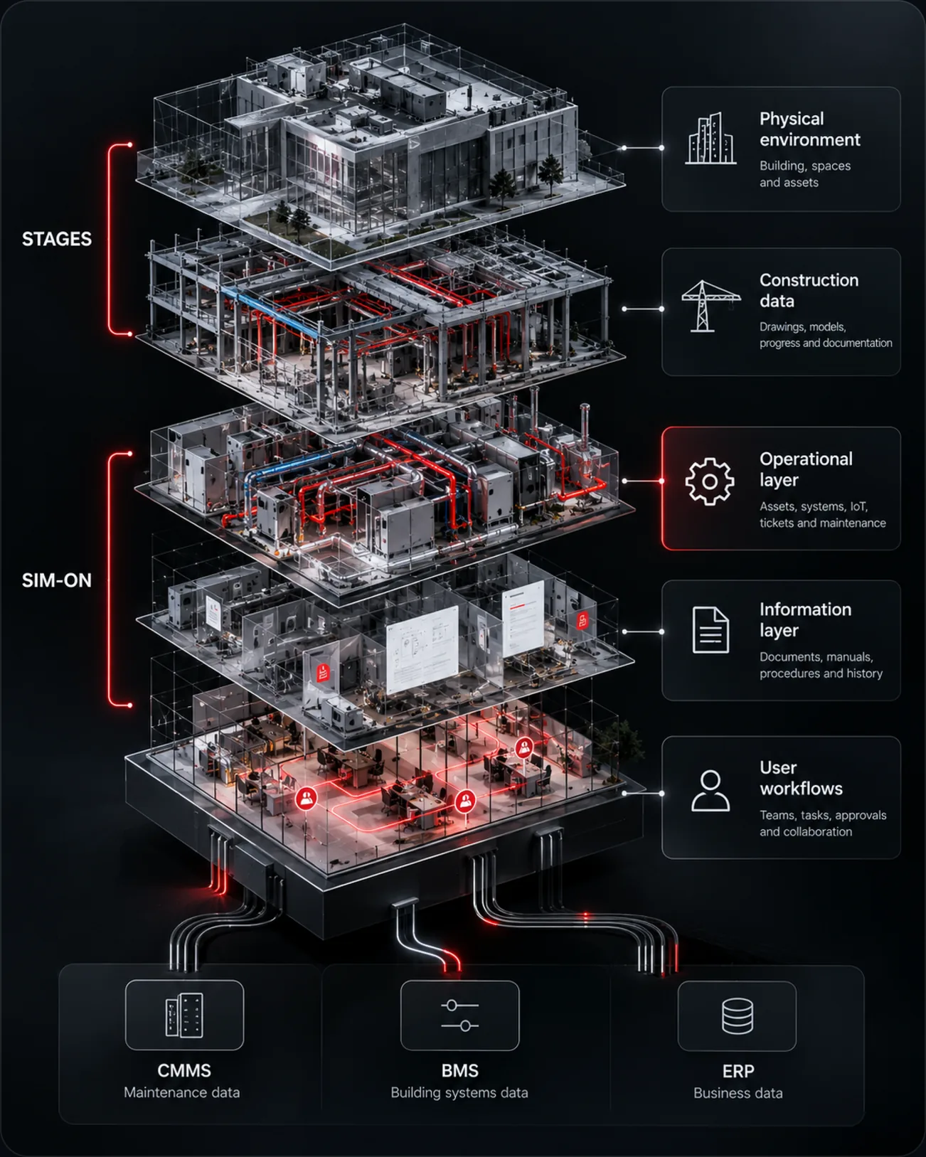
STAGES covers construction documentation, the building timeline, and handover. SIM-ON is the spatial and operational layer for assets, IoT data, and daily operations. Together they form the SIMLAB platform your architecture builds on.
Technology and innovation use cases.
Where technology, digital transformation, and innovation teams put the spatial layer to work first.
Integration strategy
Map where spatial data fits in your architecture and pilot with a clear route from proof of concept to production.
Smart building context
Give smart building initiatives a shared spatial reference, so building data reads in the context of real rooms and zones.
IoT visualization
See sensor readings where the sensors actually sit, instead of in dashboards disconnected from the building.
Enterprise system connection
SIMLAB can support connections to platforms such as Procore or IBM Maximo where approved, scoped with your IT and OT teams.
Multi-site digital twin deployment
Reuse one data structure and onboarding playbook across the portfolio, so site two is faster than site one.
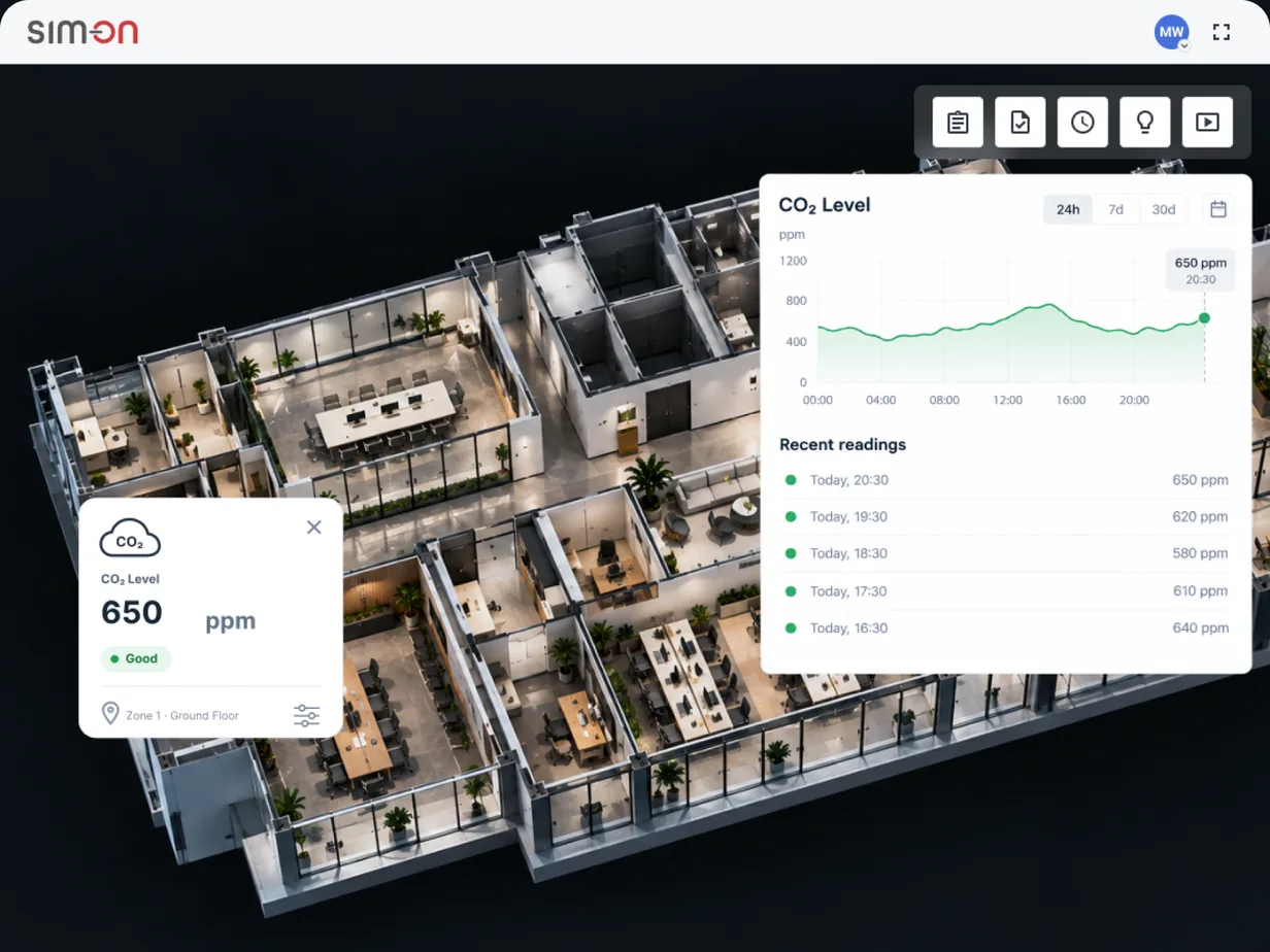
Sensor data belongs in the spaces it measures.
SIM-ON connects IoT and building automation data to the spatial model, so readings stop living in abstract dashboards.
- IoT readings displayed in the rooms and zones they come from
- Assets and their sensor data reviewed on one screen
- Operational workflows that start from the space, not from the system
Deployment considerations for enterprise teams.
A rollout model designed to earn trust site by site, instead of asking for a portfolio-wide commitment up front.
Start with a contained pilot
One building, one or two workflows, real users. Evaluate value and adoption before any wider commitment.
Connect where it counts
Integrations are scoped together with your IT and OT teams and connected where approved, so the pilot fits your governance from day one.
Standardize the structure
Naming conventions, capture standards, and an onboarding playbook turn the first site into a template for the next ones.
Scale across the portfolio
A network of capture service providers can support scanning across regions, so rollout is not limited by your own field capacity.
SIMLAB can support data from established reality capture ecosystems such as Matterport, NavVis, Leica, and Faro, and can support integrations with enterprise platforms such as Procore and IBM Maximo where approved. See enterprise integrations and the reality capture network for details.
Discuss your digital twin architecture.
Bring your stack, your sites, and your questions. We will walk through where the spatial layer fits and what a first pilot looks like.